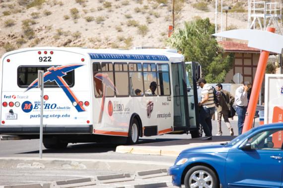
This is the first year in which the Miner Metro’s shuttles can be tracked through smartphones with a simple application. This app, called “Double Map,” tracks your location and offers different areas where shuttle routes can be tracked around the country. UTEP students can choose the option that says University of Texas at El Paso.
It’s up to students to decide which shuttle may help them out at their convenience. Jocelyn Torres, sophomore criminal justice major, encourages students to use the “Double Map” application if they plan on using the shuttle regularly.
“If you own a smartphone and you are riding on the Miner Metro shuttles on a tight schedule, this app will be a great tool for you,” she said.
“Double Map” provides a time estimation of when the shuttles will arrive at their stops in a very simplistic way, making it easy for students to navigate the application on
their smartphone.
“This application is very helpful because I use the west shuttle daily,” Torres said. “I am usually on a tight schedule every day, so it’s very convenient to know what time I can catch my shuttle throughout the day.”
Now that the school year has begun, different routes have been updated for students to track. The four are listed below:
Route 1 East (Blue)
These blue-labeled buses depart from Sun Bowl Drive from the R-6 parking lot in front of the Student Recreation Center. From Sun Bowl Drive, the shuttle travels onto Glory Road, Randolph Drive, Robinson Avenue, Oregon Street and onto Rim Road with stops in between.
The stops are taken in lot R-6, lot R-5, lot R-3, lot R-2, lot P-9, lot S5 and the Hilton Garden Inn.
Route 2 Campus Loop (Green)
The Campus Loop route provides transportation to metro stops around the perimeter of the campus, excluding areas by the remote parking lots and the Student Recreation Center. The route begins on Rim Road and rides through Hawthorne Street, Schuster Avenue, Sun Bowl Drive, Glory Road and Oregon Street.
The shuttle stops include the corner of Hawthorne Street and Rim Road, Academic Services Building, lot S-2, Sun Bowl Parking Facility, lot P-6, P-9, P-12 and the Hilton Garden Inn.
Route 3 West (Orange)
The Orange route provides transportation to the west side of the campus. The west route shuttles depart from the R-6 parking lot and travels down Sun Bowl Drive until it hits the roundabout on Sun Bowl Drive and University Avenue, and then does a U-turn in order to stay on Sun Bowl Drive and head back toward the R-6 parking lot.
These stops include the Sun Bowl Parking Facility, lot R-6, lot R-5, lot R-3, lot R-2, lot P-6 and lot P-5.
Route 4 Campbell Building
Departing from the corner of Rim Road and Hawthorne Street, this shuttle route transports students to the College of Health Sciences on Campbell Street.
This shuttle only stops at the corner of Rim Road and Hawthorne and at the college building on
Campbell Street.
Christopher Zacherl may be reached at [email protected].